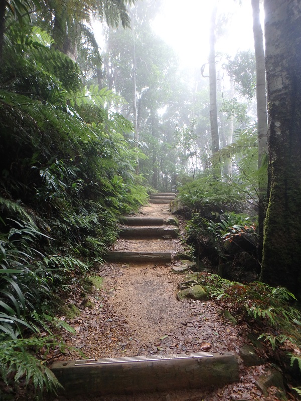
Upper Portals, Mt Barney National Park, QLD

This bushwalk has it all: creek crossings, rock scrambling, swimming holes, strenuous elevation, spectacular views, constantly changing vegetation, wide fire trails, chose your own adventure trails. Quick Info Location: Starting from Cleared Ridge Parking Area, Waterfall Creek Rd, Maroon QLD 4310 Walking Distance: 8km – 8.5km. 8km for the out and back route, 8.5km for … Read more

Mt Greville Summit Bushwalk, QLD

Mt Greville is a summit route NOT a summit track. As such, signage is scarce and navigational skills are expected. Don’t expect much of a view from the summit. However, do expect sensational views of Lake Moogerah from Slab Rock. Quick Info Location: Mt Greville Rd, Mt Maroon QLD 4310 Walking Distance: 6km return (3km … Read more

Toohey Ridge Track, Toohey Forest Park QLD

Located in the suburb of Nathan, Toohey Forest Park connects Griffith University’s Mt Gravatt and Nathan campuses. The inter campus link track has a tunnel going under the Pacific Motorway and is available to walkers and cyclists. While Toohey Ridge Track is the main bushwalking path in Toohey Forest, there are numerous other trails to … Read more

Scribbly Gums Conservation Area Bushwalk

Surrounded by suburbia, Scribbly Gums Conservation Area is well placed to serve the bayside suburbs of Brisbane. Home to Scribbly Gums parkrun, it is a space well used by locals and visitors alike. It is a perfect spot to unwind for an hour or two in nature and recharge. Quick Info Location: Corner Flinders St … Read more

Mt Maroon Summit Bushwalk

Mt Maroon is part of Mt Barney National Park. With around 600m of elevation over 3km, it is less than half the elevation required to summit Mt Barney. Even though it is a less popular summit, the 360 degree views from the top are possibly more stunning. Quick Info Location: Cotswold Track, Cotswold Rd, Mt … Read more

Cronan Creek Falls, Mt Barney

Cronan Creek Falls is a hidden gem in Mt Barney National Park. With a naturally formed pool at the base of the waterfall and beautifully clear waters, it is an ideal place to try out bush swimming. Quick Info Location: Yellow Pinch Trailhead, Upper Logan Rd, Mt Barney QLD 4287 Walking Distance: 12km, out and … Read more

Girraween National Park, Bald Rock Creek Circuit and The Junction, QLD

Girraween, indigenous for ‘Place of Flowers’, is mind bogglingly stunning. One could be excused for mistaking it for a giants playground. Enormous boulders balanced precariously will leave you wondering HOW!!! Girraween National Park is a testament to the power of natural elements and time. This is a unique nature experience, one that hopefully will stay … Read more

Girraween National Park, Castle Rock, The Sphinx, Turtle Rock, QLD

Girraween, indigenous for ‘Place of Flowers’, is mind bogglingly stunning. One could be excused for mistaking it for a giants playground. Enormous boulders balanced precariously will leave you wondering HOW!!! Girraween National Park is a testament to the power of natural elements and time. This is a unique nature experience, one that hopefully will stay … Read more

Cascades Circuit, Main Range National Park, Goomburra Section, QLD

With around a dozen creek crossings, Cascades Circuit is the most fun bushwalk in Main Range National Park, Goomburra Section. The multiple creek crossings also makes it the most photogenic. Location: End of Forestry Reserve Road, Goomburra QLD 4362 (2.5 hours SW Brisbane) Walking Distance: 6.5km Elevation: 250m Time: 3 hours Difficulty: Moderately Hard Costs/Permit: No … Read more

Palm Grove Section, Tamborine Mt QLD

After setting a goal in 2020 to complete all the bushwalks on Tamborine Mountain, I finally experienced the serenity of the Palm Grove Section. Despite living in Brisbane for 25 years and visiting Tamborine Mountain dozens of times, I had never been to the Palm Grove Section. Without the fancy drawcard of a waterfall that … Read more

Enoggera Dam Reservoir Bushwalk QLD

Don’t be tricked by the lack of blue on the map, Enoggera Reservoir really does have water in it. The tracks that circuit the reservoir can be easily accessed from the Park n’ Ride at The Gap. While there isn’t one easy to follow circuit track, having GPS on hand will help keep you on … Read more

Mt Edwards Summit Bushwalk, QLD

Prepare for the most exhausting 3km of your life! While not technically challenging, Mt Edwards will challenge your mental stamina. The 3km hike to the summit involves 500m of elevation – guaranteed to get your heart pumping. If you pace yourself and have a moderate level of fitness, this mountain is totally achieveable. Quick Info … Read more

Karawatha Forest, QLD

Hidden in the midst of suburbia, Karawatha Forest is a credit to Brisbane City Council. The forest is set on over 900 hectares and encompases dry eucalypt forest, lagoon and wetlands, natural playgrounds and an interactive discovery centre. With over 20km of tracks there is something to suit everyone. Quick Info Location: 149 Acacia Rd, Karawatha … Read more

Lake Manchester, QLD

Lake Manchester was confusing. So much hard work for very little reward, yet it felt like an achievement. Baffling that a bushwalk around a lake would contain so few views of said lake. Having said that, the few views that were glimpsed were quite lovely. Quick Info Location: 667 Lake Manchester Road, Lake Manchester QLD 4306 … Read more

Mt Coot-tha Forest Bushwalks, QLD

Just 5km from the Brisbane CBD, Mt Coot-tha Forest is a must do nature experience. Introduce interstate and international visitors to the best of Brisbane with a day at Mt Coot-tha Forest. Quick Info Location: Mt Coot-tha Rd, Mt Coot-tha QLD, 4066 Walking Distance: 2km-60km Elevation: Some hills, some very steep hills Time: 1 – 8 hours Difficulty: Easy to … Read more

Daisy Hill State Forest, Buhot Creek Circuit Bushwalk, QLD

Buhot Creek Circuit in Daisy Hill State Forest is one of the longer trails in the forest. The circuit is ideal for an immersive experience –  just take a map with you so you don’t immerse yourself for longer than expected! Quick Info Location: Daisy Hill Road, Daisy Hill, 4127 Walking Distance: 9km Elevation: Numerous hills Time: 3+ hours … Read more

Daisy Hill State Forest, Old Quarry Bushwalk, QLD

The Old Quarry is an unexpected treasure in Neville Lawrie Reserve, which adjoins Daisy Hill State Forest. I’d lived in the area for 20 years before I heard about the Old Quarry, and have since visited regularly to make up for lost time. The quarry is a welcome oasis in the midst of the usually … Read more

Dove Lake Circuit Bushwalk, Cradle Mountain, TAS

I was expecting Dove Lake to be amazing – unfortunately I was underwhelmed. Dove Lake Circuit is promoted as one of the must do activities for those holidaying around Cradle Mountain. For me, the hassle involved in getting there took the shine off the experience. Quick Info Location: Dove Lake, Cradle Mountain, TAS 7306 Walking Distance: 5.7km circuit … Read more

Fitzroy Falls Bushwalk and Lookout

Fitzroy Falls, in the Southern Highlands of NSW, is an 81 metre waterfall  flowing down a sandstone escarpment into the valley below. It has only been know to dry up once in living memory, so odds are it will be flowing for your visit. The picturesque drive there comes close to surpassing the beauty of … Read more

Daisy Hill State Forest, Paperbark Trail, Lake Dennis, QLD

Daisy Hill State Forest is a treasure trove of tracks and facilities. Whether you have a hour to spare or the whole day, Daisy Hill State Forest has something to offer. The forest caters to diverse users such as: bushwalkers, school groups, mountain bike riders, rogaine adventurers, wedding parties and horse riders. A 2km ring road, … Read more

Mount Warning Summit Climb Hike

One of my all time favourite bushwalks. Beautiful rainforest, flowing creek, inspiring views and crisp mountain air, with a challenging rock scramble at the end – all on a well maintained path. The super elite may be able to complete the hike in 2 hours, but anyone with a moderate level of fitness will have … Read more