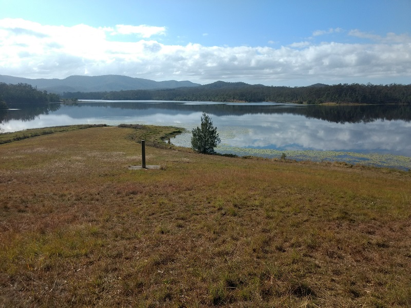
Lake Manchester was confusing. So much hard work for very little reward, yet it felt like an achievement. Baffling that a bushwalk around a lake would contain so few views of said lake. Having said that, the few views that were glimpsed were quite lovely.
Quick Info
Location: 667 Lake Manchester Road, Lake Manchester QLD 4306
Walking Distance: 17km loop
Elevation: Many hills, some ridiculously steep
Time: 6 hours
Difficulty: Moderate to Difficult
Costs/Permit: No cost, no permit required
Opening Times: Sections closed occasionally for maintenance
Facilities: Toilets, picnic table, gas BBQ, car park, horse riding, cyclists
What to take: Water – at least 2L per person, camera, hat, sturdy good gripping shoes
Map:
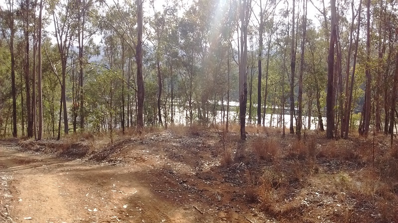
For a bushwalk around a lake the trail is astoundingly hilly. The loop can be tackled clockwise or anticlockwise. Clockwise will have you tackling the steepest hills first rather than leaving them for the end of the hike when your legs might be a bit more wobbly.

The few glimpses you get of Lake Manchester are lovely. Good views of Lake Manchester Dam are available at the begining of the walk when travelling clockwise.

Really good shoes are essential for this bushwalk. There is loose gravel on all the tracks. On the steepest hills I was slipping down whilst trying to go up. Of course descending the steepest hills was very precarious. Imagining the slopes as a slippery slide wasn’t too much of a stretch for the imagination.

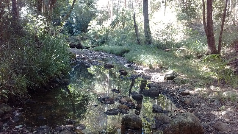
There are half a dozen creek crossings along the track. If you go in the dry you might find water in one of the creeks. If you go in the wet it is possible to get wet up to your knees. The green around the creek beds makes for a welcome reprieve from the unrelenting brown of the rest of the track.
There is an old cabin about one third of the way along the track, next to the lake. This makes for an ideal picnic spot. The track could do with better signage, especially some indications of distances would have been helpful. Following the signs that showed people, horses and bikes seemed to be the most reliable.
Choose your time of day and year wisely for this bushwalk. Summer would be scorching. Take plenty of water and be prepared for snakes. Mobile reception is not available in all parts of the track so make sure someone knows where you are.