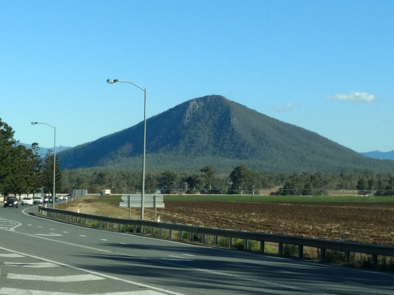
Prepare for the most exhausting 3km of your life! While not technically challenging, Mt Edwards will challenge your mental stamina. The 3km hike to the summit involves 500m of elevation – guaranteed to get your heart pumping. If you pace yourself and have a moderate level of fitness, this mountain is totally achieveable.
Quick Info
Location: Haigh Park, Lake Moogerah Picnic Area, Moogerah Connection Rd, Mt Edwards, Qld 4309
Walking Distance: 6km return after crossing the dam wall
Elevation: approximately 500m
Time: 3 hours
Difficulty: Moderate – rocky path most of the way, 500m elevation
Costs/Permit: No cost, no permit required
Opening Times: Access only available when the dam wall is open, 6am to 6pm
Facilities: Toilets, picnic area, playground, The Dam Cafe (limited opening hours), nearby boat ramp and camping
What to take: Lots of water (I consumed1L on the assent in winter), insect repellent, sturdy footwear, snacks, hat, sunscreen
Map:
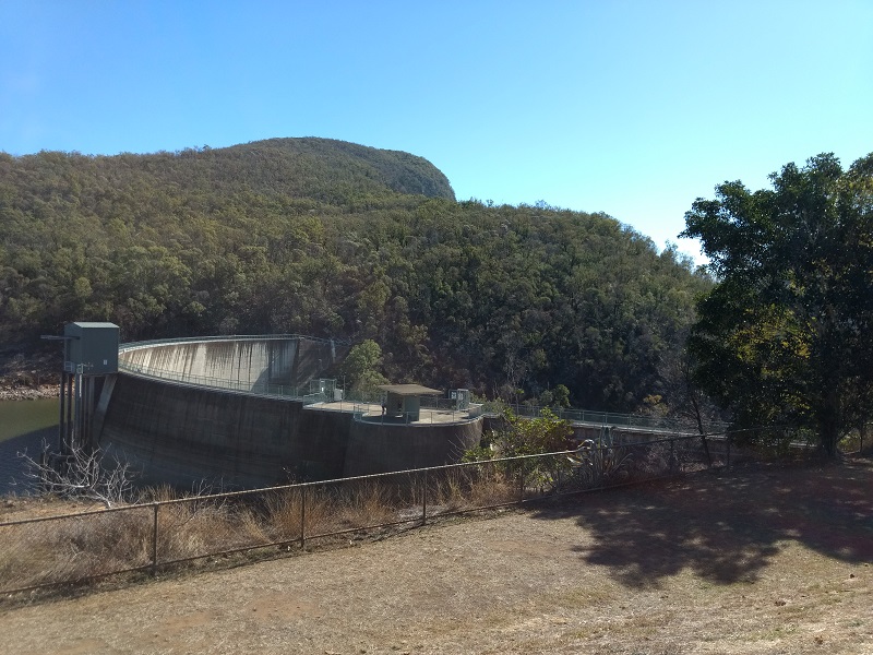
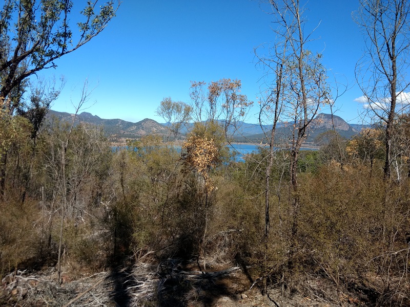
Mt Edwards’ summit track is accessed by crossing Lake Moogerah’s dam wall. On the day I climbed Mt Edwards, water was flowing out and could be heard for about one fifth of the way along the summit track.
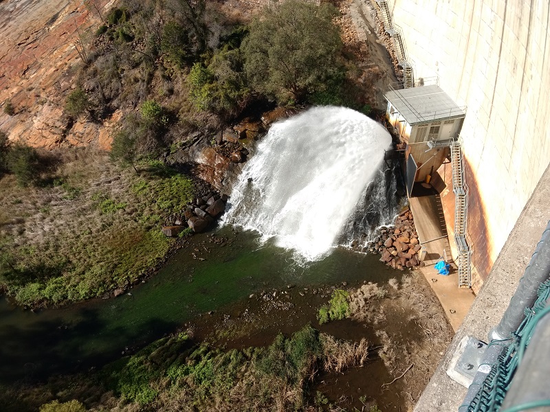
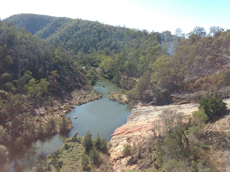
The dam wall affords pretty views of Reynolds Creek, which flows away from Lake Moogerah. A picnic area and playground can just be seen in the distance, begging for further exploration.
The summit track is not well signed, however it is fairly intuitive – you would really have to do something wrong to get lost. The track could definitely benefit from distance markers. Half an hour into the hike it was really hard to guess how far there was still to go. Mind you, distance markers may have proved to be very discouraging!

Mt Edwards summit walk can be broken down into three sections. The first section, of just under 1km, gets you to the rocky plateau area. Here you are rewarded with stunning views of Lake Moogerah if you veer a little left off the path.
The second section is the steepest part of the bushwalk. Don’t be disappointed if you need to keep having breaks to catch your breath. This section is VERY exhausting, but not hard. You don’t need mountain goat DNA to succeed here, just a moderate level of fitness and enough time. And water. And maybe chocolate brownies. No, definately chocolate brownies!
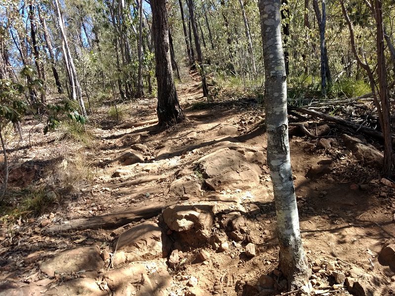
The track is very rocky and very dusty. The red dust made its way into every crevice. I wouldn’t be keen to do this bushwalk in summer. In winter it felt hot, summer would be scorching. Bushy scrub provides patchy shade for the majority of the walk.
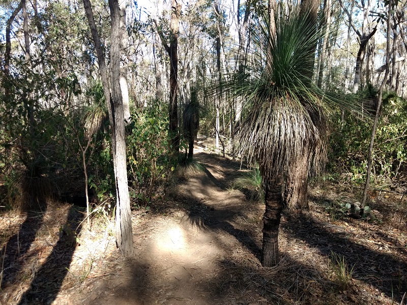
By the time you reach the grove of grass trees you are well into the final section of the bushwalk. This last section had me confused, it felt more like it should be at the base of the mountain than near the summit. The whole mountain climb was confusing. Even from the beginning it looked like the summit was only ever 100m away. 2.5km later the summit still looked 100m away. Thankfully, we finally reached the summit, and all that hard work paid off.
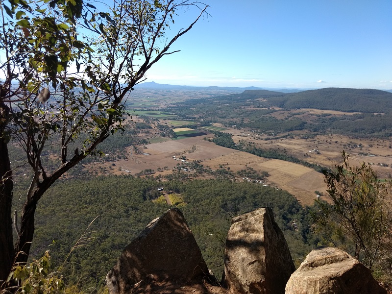
Make sure you allow time to stop and reflect at the top. The 180° views are pretty special. On a clear day, Brisbane CBD can just be made out in the distance, and look out for eagles playing in the thermals. While this is a very strenuous climb, the serenity at the summit makes it worthwhile.