
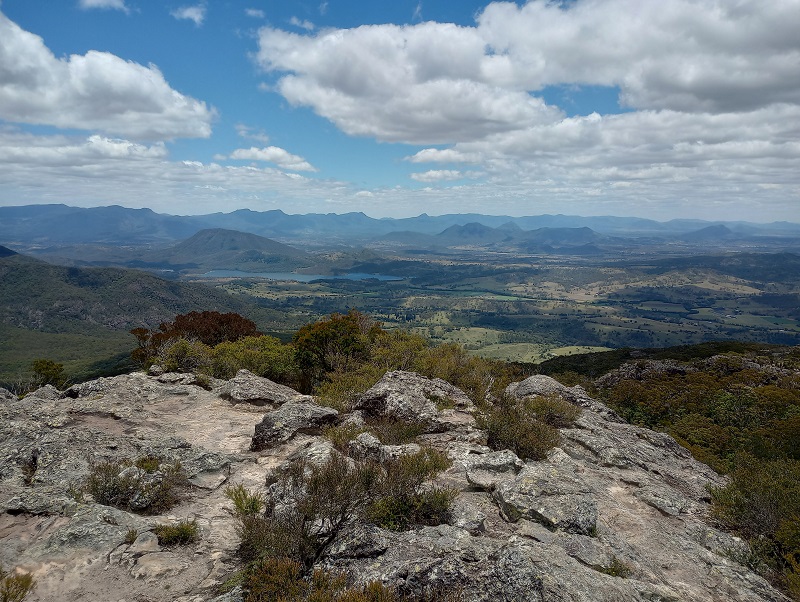
Mt Maroon is part of Mt Barney National Park. With around 600m of elevation over 3km, it is less than half the elevation required to summit Mt Barney. Even though it is a less popular summit, the 360 degree views from the top are possibly more stunning.
Quick Info
Location: Cotswold Track, Cotswold Rd, Mt Maroon QLD 4310
Walking Distance: 6km return (3km each way)
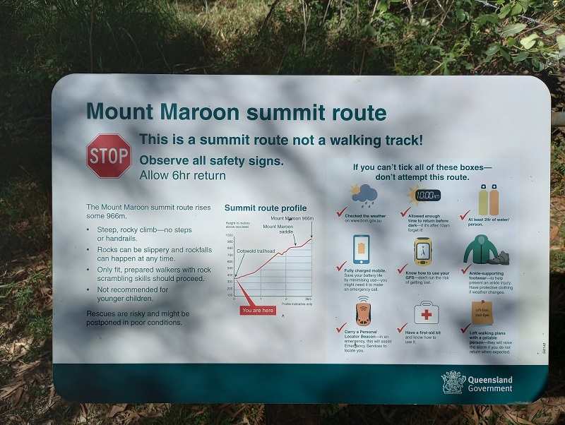
Elevation: approximately 600m
Time: 5 hours
Difficulty: Hard – rock scrambling, elevation, navigation
Cost/Permit: Nil
Opening Times: Some tracks closed occasionally for maintenance
Facilities: Negligible! Information/warning sign. Parking for a dozen vehicles. Nearest public toilets in Rathdowney
What to Take: 2L water per person (Staminade or similar would be even better), snacks, topographical map, personal locator beacon, hat, sunscreen, camera
Map:
Located at the very end of Cotswold Rd, the Mt Maroon summit bushwalk is about an hour and a half SW of Brisbane. Although the last few kms of the drive is on a dirt road, a 4WD is not necessary.
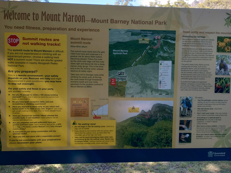
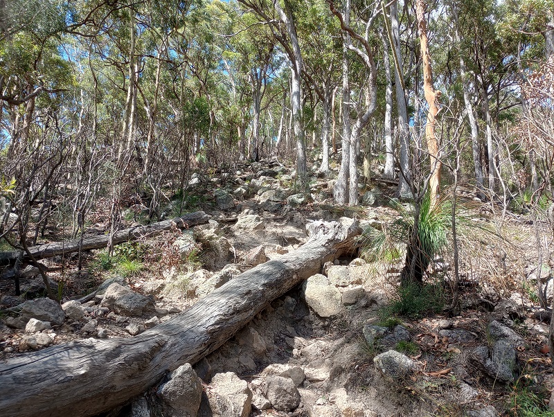
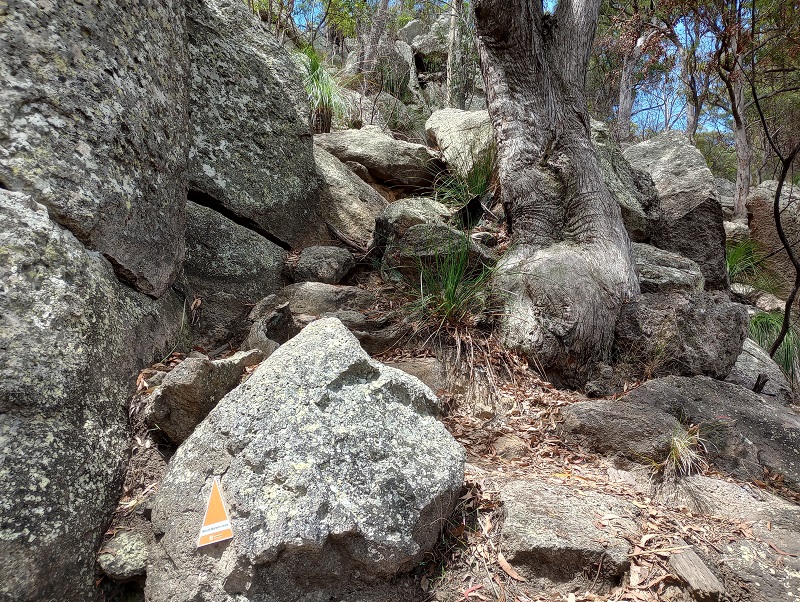
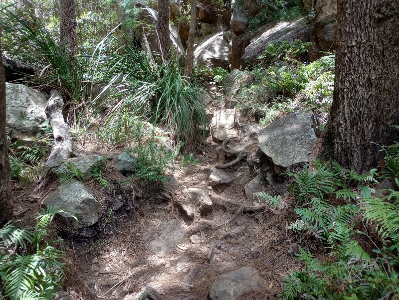
This is a summit route NOT a walking track! As such there are no well defined paths. Expect to spend a portion of the hike a little unsure of if you are on the right track.
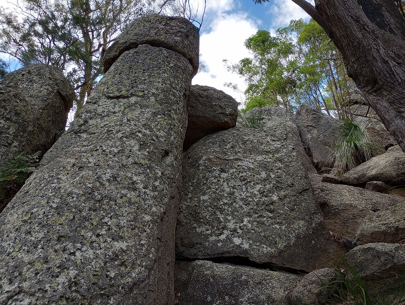
The walk starts off steep and then gets steeper. It is consistently hard going, rock scrabbling is required in places, but at no point did it feel risky. There is some shade most of the way.
Mt Maroon boasts some interesting rock formations. While not on the same ‘wow’ level as Girraween, they are still pretty impressive.
Keep an eye out for the orange triangle markers. They are always a reassuring sight to see in the distance. A few more wouldn’t go astray. I didn’t spot the first one until about 1.4km in.
Along the 3km hike, the terrain varies considerably. Amazing views greet you the whole way. Expect to use 75-80% of your water on the way up. Consider having a sports drink to help manage hydration. Taking Staminade powder in a zip-lock bag, and adding it to water as needed worked really well.
After passing through a grove of grass trees, 200m further along is the summit. What a view! Worth every drop of sweat.
There is plenty of space at the top to sit and refuel. You’ll need refuelling before beginning the full body workout that is the descent.