Mt Mitchell is located in the Cunninghams Gap section of Main Range National Park, which is part of the Gondwana Rainforests of Australia World Heritage Area. 116km west of Brisbane, Mt Mitchell is a great place to escape the busyness of city life and enjoy a nature adventure.
Quick Info
Location: Crest Carpark, Cunninghams Gap, Tregony, Qld 4370
Walking Distance: 10.2km
Elevation: 425m
Time: 3-4 hours
Difficulty: Moderate
Costs/Permit: No cost, no permit required
Opening Times: Only closed occasionally for maintenance
Facilities: Toilets, information board
What to take: Insect repellent, camera, picnic, water, sunscreen
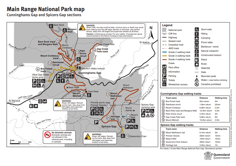
Map:
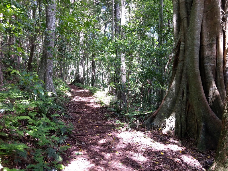
Possibly the most dangerous part of climbing Mt Mitchell is crossing the Cunningham Highway to get to the beginning of the track. Watch out for cars wanting to overtake trucks lumbering up to the crest of Cunninghams Gap. The first 500m of this out and back track is through rainforest which then opens up to weedy bush.
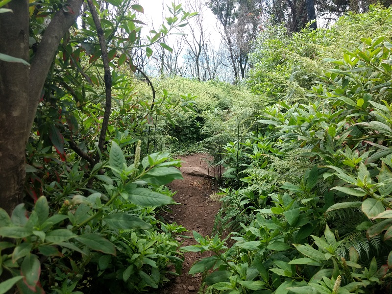
Unfortunately, due to recent bushfires in the area, much of the open bush has been overrun with weeds. Weeds were commonly knee to waist high, sometimes even higher. This continues for approximately 2.5km, when rainforest begins again.
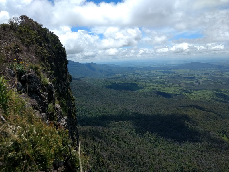
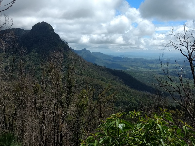
Gorgeous views of Mt Cordeaux are gained while on the north side of Mt Mitchell. Many openings in the vegetation allow for picture perfect photographic opportunities.
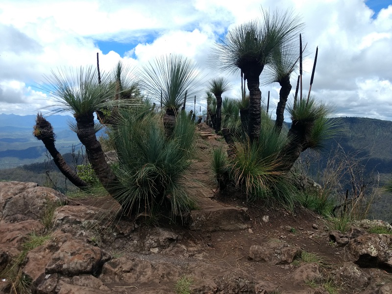
The final kilometre to the summit is through weedy bush again. Some rock stairs have been constructed, to navigate the rapid increase in elevation required, that are sloped, narrow, and shallow. Take care here. Mt Mitchell has 2 peaks: the west peak is 1162m and the east peak is 1175m, they are connected by a saddle. The east peak is on a knife edge ridge above a cliff, which offers 360 degree views. Apart from the initial road crossing, this area holds the greatest potential for danger. Stick to the designated areas!
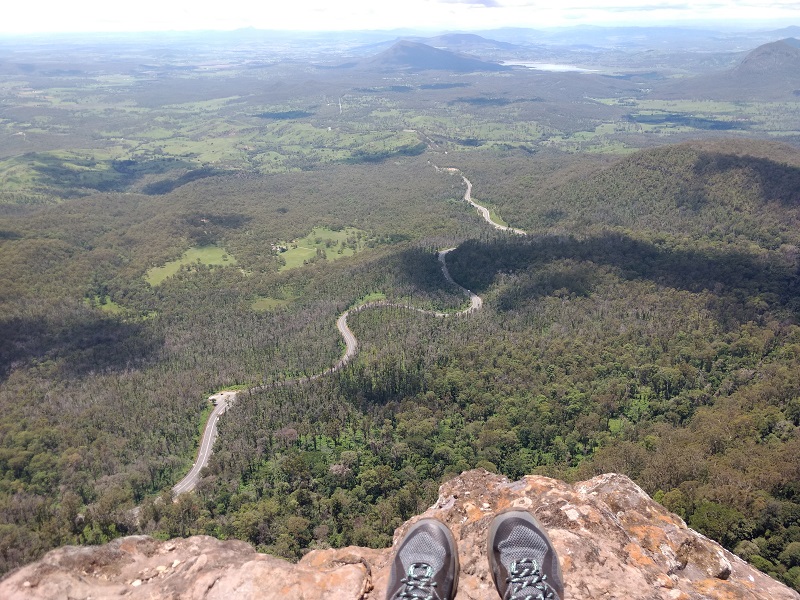
On a clear day, views from the east peak extend to Brisbane city. Keep a lookout for peregrine falcons playing in the thermals. The east peak in particular is very exposed, so be prepared for any and all types of weather. Traffic can be heard from here, as it could for most of the hike.
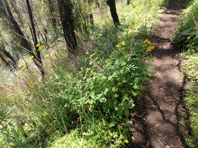
Pretty wildflowers dotted parts of the trail. There were even pretty prickles. This track was a bit of an education in the variety of prickles that exist. All of the plants attracted millions of insects – swarms of them.
Overall, while the amount of weed along the track was disappointing, the views at the summit made up for it. I will be keen to do this bushwalk again in a few years to see if the forest has been able to reclaim that which bushfires took and weed took advantage of.